

Photo Credit
"Careful, man, looks like that entire boulder could pull out of the wall," Jackson shouted up to me from far below the scree field, a slippery slope of teetering blocks and flaky terrain. Sure enough, after lightly touching the fridge-sized stone in front of me, it groaned and shifted, nearly losing its perch hundreds of feet above the sweeping Cirque of the Towers valley beneath us.
"This is supremely sketchy!" I hollered back at him. And it was. The Cirque of the Towers Traverse had been mainly technical climbing up to this point, but even though we were no longer roped up, this scramble up the chossy back side of Watchtower seemed the most dangerous part of the mission. It was well after dark on day two, and our headlamps sent slices of yellow dancing over the broken wall above. We still had a long night of slogging ahead. Brutal. But what a magical way to experience this gem of rugged wilderness.

The Cirque of the Towers Traverse is a massive, spectacular alpine rock traverse of the 11 major peaks in the Cirque area of Wyoming's Wind River Range. It includes the otherworldly peaks of Pingora and Wolf's Head, both in the Fifty Classic Climbs of North America (Pingora's Northeast Face route is on the list, though most climb the South Buttress for the traverse). The route begins by climbing Pingora and ends at Warbonnet Peak. Most parties do the traverse over two days—as we did—but it's feasible to do it in one long day. It includes roughly 20 pitches of technical climbing, with significant 3rd- and 4th-class scrambling to summit the remaining moderate peaks. For more detailed pitch-by-pitch beta, it's best to reference the official Mountain Project route pages for each peak, as well as the comments. This report offers plenty of route guidance but is primarily a recounting of our personal experience.
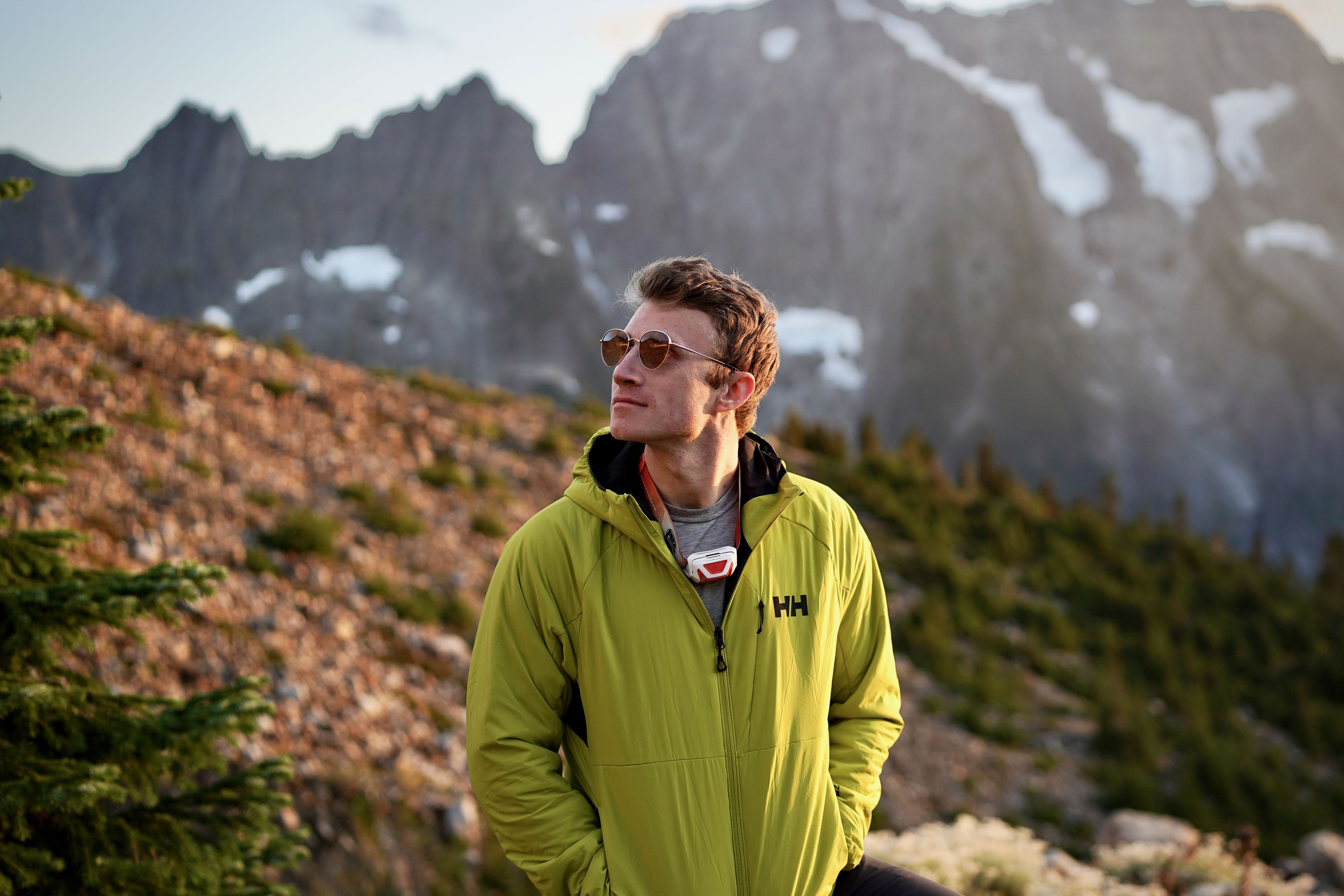
In 2021, I thru-hiked the Continental Divide Trail, and opted for the "Cirque Alternate" route through the Cirque of the Towers. This was my first intro to the area, and it completely floored me. Trotting along the base of the dramatic spine of peaks, I made a mental note to return for the traverse climb one day. It just seemed like the most natural, awe-inspiring way to experience this unique landscape. Three years later, I finally followed through, partnering with Jackson Sims-Myers, with whom I also hiked the Appalachian Trail in 2021.

Most climbers access the Cirque from Big Sandy trailhead and establish a basecamp between Jackass Pass and Pingora. Our basecamp was 8.1 miles (and 1,764' of elevation gain) from Big Sandy to near the base of Pingora. It's a significant haul, so plan accordingly and factor in the time it takes to set up base camp, then the roughly 0.7-mile approach from base camp to where the scramble up the side of Pingora begins. We opted for an early start from Big Sandy to begin the actual traverse in the afternoon, giving us plenty of time to tackle Pingora and camp in the notch between Pingora and Watchtower, or further if time allowed. From Big Sandy TH, follow Big Sandy Trail toward Jackass Pass past Big Sandy Lake and North Lake. Soon after North Lake, you'll want to begin looking for the climber's access trail to the left that loops around the west side of Arrowhead Lake. If you pass this cutoff, the basecamp can also be easily reached from Jackass Pass. There are many flat campsites on a plateau overlooking a drainage running down to Lonsesome Lake. The deproach follows the same route back to Big Sandy.

Because of its enclosed, high-walled terrain, the Cirque often feels colder than the surrounding areas, and storms can build quickly, making forecasts less reliable than you’d hope. Mosquitos can also be a serious issue in the summer, especially after wet periods. Mid-August through early September is considered the prime climbing window, but even then, the range can be fickle. Mountains make their own weather. We did this route on September 14-15 and saw zero other parties the entire time we were in the range. I do feel like we lucked out with our weather window, despite a brief snowstorm on Shark's Nose. Aside from that, daytime temps were perfect for climbing, and we only felt cold at night.

While much of the route can be soloed (climbed without roping up or using protection), there are pitches that we felt necessary to be tied in for. It felt comforting to have enough pieces for even the simple sections due to the extreme exposure. We used a single 8.9 mm 60 meter Sterling rope (sufficient for all raps), singles of Black Diamond C4s #0.1-3 (doubles of #0.75, ultralights when we had them, and we probably could have gotten away without the #2 & 3 to save weight), a black and blue Totem (we could have done without these), 4 alpine draws and 4 quickdraws (I would bring all alpines next time), a very slim set of Black Diamond stoppers and offsets (more to reinforce the raps than anything), and 2 short cordelettes to backup raps. I believe we left one strand on route—there are some seriously manky stations out there that could use some love. See my dedicated gear section below for more info on what we used.

The climber's base camp near Pingora (coordinates: 42.76941, -109.21923) offers many flat, cleared spots for standard backpacking tents close to a stream. From this starting point, it is entirely feasible to do the traverse in one push and return to base camp, but we opted to pack for one night on route, given the unpredictable September conditions. Adequate bivy ledges abound on the traverse. While there are long stretches (such as Wolf's Head) where the terrain may be too rugged to comfortably overnight, we felt like we could have finagled an acceptable bivy in the cols between most peaks along the route—though some would be quite squished. Several great spots around the rappels from Shark's Nose stood out to me. Our bivy site near the start of Wolf's Head was fine, but exposed and windy.

The rappels (raps) can be rough on this route, and can suck up much of your time. Locating each first rap station is often a chore, but once you begin, each subsequent station feels intuitive for the most part. Many raps involve long traverses as you work your way south towards the next peak. The long series of raps off of Wolf's Head and Shark's Nose felt particularly convoluted. I want to say we did 17 raps the entire route, but I stopped counting after Shark's Nose, and there were several easier sections we downclimbed to save time. Each rap can be done with a single 60-meter rope. Some stations are bolted with rap rings; others are held together with a prayer (a loose, wobbly one at that). Many are just old stoppers bashed into cracks and backed up with weathered tat (like on Block Tower), or slung around horns.

It seems there is an honor system where each party that attempts the traverse sacrifices some webbing or cordellete to back up these manky stations, since there is a colorful nest of old and new tat at each one. We paid the piper on a couple, and held our breath in fear when clipping into others. In the end, I recommend bringing some thin cordelette to reinforce the dangerous stations, along with a handful of stoppers you don't mind leaving behind. Many of the raps are also wildly exposed and free hanging, so bring a third hand.

Ultralight is the name of the game on traverses like this, and we wanted to strike a healthy balance between weight and calories in our pack. For that reason, we brought calorie-dense freeze-dried backpacking meals up with us to base camp (Pinnacle Foods Co. and Good To-Go Meals were our picks), and carb-loaded as much as we could before starting the climb. We treated the traverse as an ultramarathon and packed light race fuel for the climb itself. We opted to snag a curated box from Fuel Goods, a sweet service where race nutrition experts put together packages of endurance fuel for sustainable energy. We got the RunnerBox and a few extra Honeystinger Waffles (my personal favorite for endurance events), and it was the perfect balance for this climb. They are all lightweight products, and meshed well with our kit.
Regarding water, there are no reliable sources along the route. After some deliberation, we opted to bring two liters each. Water is always tough on rock climbs because it weighs your pack down the most and can make a 5.7 feel like a 5.10. We knew this would be cutting it close (and it was), but it worked out with some strategic rationing, and we were grateful for the lighter packs. We were both uncomfortable by the end, though. Some reports from earlier in the season noted pockets of snow or runoff to refill, but we encountered none along the entire route. The base camp is near a reliable drainage running into Lonsesome Lake, so water isn't an issue there.

It's not in America's 50 Classics for nothing. Pingora is a national treasure of a climb in itself, so it's a joy to get to tick it off via the South Buttress as the first peak of the traverse. The technical climbing doesn't start until you're way off the deck, and is reached via a well-worn trail from basecamp that heads up towards Cirque Lake. Soon after passing the lake to your left, look for a smaller trail cutting up to the right to gain the south shoulder of Pingora. Exposed, class 3 climbing up an obvious right-leaning ramp leads you to mellow flat terrain, after which you double back and head north to the base of the 4-pitch S Buttress route (aim for the large right-facing corner system). We were just getting warmed up, but the climbing felt sustained—though mellow—right out the gate. Jackson led P1, and I took over for a fun, flaring right-facing corner on P2. I had just come off a summer of mainly backpacking, so I felt the forearm pump sneak in quicker than I would have hoped.

Jackson crushed another techy hand crack for P3, and belayed me up to the large ledge at the base of the famed K-Cracks, clearly visible from far below in the valley. I'd heard of this fun, exposed pitch for years, so I was stoked to sink my hands into the overlapping seam and sneak peeks behind me at the sprawling scenery emerging ever more around us. 5.8 felt like 5.9+ with a full overnight pack on, and this pitch wasn't a gimme. I love how multi-pitch climbing slowly unveils deeper and deeper layers of the mountains around you as you nudge and grunt your way higher. It tempts you with that ultimate view from the peak, but you're forced to gradually, methodically unlock the sequence to the top—no shortcuts in the alpine. It makes that zenith much more rewarding than if you were to simply drive to the overlook. And what a view from the top of Pingora! We reveled in our first panoramic glimpse at the daunting traverse we were about to tackle... and forced down some mounting trepidation.
Beta note: The first rap station off of Pingora can be tricky to spot. It involves a few 5th-class moves around to skier's left on the west side of the summit. There is an easy crack you have to downclimb to reach a ledge, and the rap station is tucked away to skier's right.

Yet another 50 Classics Climb. The East Ridge of Wolf's Head is famous for many reasons, but its dizzying exposure is cited most often. The climb is technically 10 pitches long, but most teams simul-climb or link most of them. However, we wouldn't get to experience it until the following morning. It's one of the more technically convoluted stretches of the traverse, involving weaving between four distinct towers before navigating a summit block, and we didn't want to unlock that in the dark. The sun was dipping low as we finished the rap into the col between Pingora and Wolf's Head, so we decided to bivy early and tackle the beast with an alpine start. We brought two ultralight sleeping pads with us, but opted to share a single quilt to save weight—a decision we paid for dearly. The wind was manageable at first, but whipped up violently after dark, making it nearly impossible to keep our bedding from getting snatched into the ether. We tried everything to huddle together and trap the quilt under our bodies, but the freezing gales kept squirming their way in and splaying it open. We passed a truly heinous night with barely any sleep.

We woke before the sun—though we didn't quite fall asleep in the first place—and packed up as quickly as possible in the biting cold and relentless wind. With no promise of water refills on the entire traverse, we carefully conserved our rations. Thirst already began to hit with a hammer. Feeling miserable overall, we poked around in the dark until reaching the headliner of Wolf's Head: a dramatic three-foot-wide blade of stone stabbing up a 30° slope, with sheer faces on either side dropping to the valley below. A peerless gem of a climb. Though the ramp is 5.2 max, this was the most awe-inspiring pitch of the climb—punctuated by a brilliant sunrise that smacked our backs just as we set off. A truly magical moment. I shuffled tenderly up this daunting, runout slab, half wanting to rush to safety, half wanting to sit in the middle and prolong the feeling of flying. Jackson whooped and hollered behind me, fully aware I was having a spiritual experience.

Our spirits rose with the sun, and we charged into the maze of peaks ahead with renewed strength. We were immediately faced with the technical, convoluted nature of this futuristic climb. The East Ridge route weaves between four distinct towers, alternating between vertical and traversing pitches on the north and south sides of the ridge. From a bird’s eye view, it seems simple. But the path is a 3D maze of ledges, chimneys, and various levels—getting lost can cost serious time and plunk you on an entirely different trajectory. Jackson and I had studied the topo religiously, but still scratched our heads after reaching the first tower. I passed this peak on the south side by making a gripping, exposed move around a protruding boulder, then aimed for a steep chute below an obvious chimney between Tower 1 and 2. Here I met my first logistical match. According to the topo, you just squeeze through the chimney to reach a ledge on the north side… but I simply couldn’t find this ledge. I removed my pack and shoved my body through a suffocatingly narrow slot, only to peer down to a sloping ramp far below on the other side. This couldn’t be right.

Frustrated at the wasted effort (and cuts), I scuffled back out and hollered at Jackson to read the description once more. Nothing new stood out. Every second counts on these traverses, and the thirst/hunger clock was perpetually ticking in our minds. I was wasting a ton of time here… on the first technical pitch of the day. Aggravated, I crammed my way back through the tiny slot, collecting more scrapes and bruises, to ensure I didn’t miss anything. Finally, I noticed what seemed to be faint shoe-rubber smudges above my head, and committed to some chimney moves straight up. I’m not sure if I was more relieved or humiliated to find the advertised ledge perched just above where I originally exited the slot. Rookie mistake. I finally belayed Jackson up, and we shared nervous jokes about the weeks it would take us to complete the traverse at this pace. Doubt crept in again.
Beta note: Begin stemming up the chimney early before it pinches down to gain the ledge (pictured above), which is higher than you’d think and is tricky to spot from within the slot.

The next tower proved much more intuitive, however, and Jackson cruised the famous “piton pitch” on the north face to a gorgeously exposed stance below the money hand traverse of Tower 3. With renewed stoke, I tied in and climbed a layback for 20 feet to gain the very spine of the mountain. What a position! The line ahead guided me onto the north face of Tower 3 into a quintessential horizontal hand crack, punctuated by 1,000+ feet of dizzying air beneath me. We both yipped with excitement as the wind whipped up, and I began to understand why this route is in the 50 Classics. Jackson then navigated another complex jungle gym of traverses and squeezes around the south side of Tower 4 (the "black nubbins" pitch), and we simul-climbed up the summit block with much rejoicing. Wolf’s Head was a battle, but reaching the end felt like a serious checkpoint. We paused a second to celebrate and eat a bar, then quickly navigated the many raps into the notch below the Overhanging Tower (which felt harder than it should have).

Despite its name, the route up the unique Overhanging Tower is one of the easier climbs of the technical peaks (though the slab pitch near the top can feel heady). We donned our approach shoes and quickly scrambled unroped to a broad flat platform at the summit, staring straight at the fractal of jagged stone blades ahead of us. We crushed this peak in no time, and it felt good to tackle something so quickly compared to our pace on Wolf’s Head. But the relief was short-lived. This stance gave me a new, humbling perspective of the gnarly terrain we had just thrown ourselves into. It was still going to be a grueling day. Also, while we’d been graced with bluebird skies to this point, angry storm clouds began to wrestle each other to the west of the range, and the wind was anything but mellow. “Let’s definitely rap with a purpose and try to tackle Shark’s Nose before that storm hits us,” Jackson mused. We’d heard several stories of how difficult this next peak could be, and didn’t want to unlock the sequence in rain (or snow).

Beta note: The rap/downclimb from Overhanging Tower is pretty straightforward into the col between the two peaks. You then walk climber's right (west) down the col to begin Shark's Nose. There are two ramps to the left, and you want to begin the route on the higher one.
It’s easy to read “5.6” and think the Shark’s Nose is going to be a cakewalk, but this was the obvious crux of the traverse for us (both the climb and rappel). From the get-go, route finding proved complex. We simul-climbed up the higher of two ramps angling up climber’s right, past some fixed gear, and kept an eye out for a crack system that exits the ramp to the left. Directions are murky here, and we both tried multiple routes off the ramp before backing down to safety (I recommend thoroughly reading the Mountain Project page for the NW Buttress, including the comments, for the best chance of success). After several attempts, I finally found the correct right-leaning web of cracks that leads up around to the west side of the ridge (keep an eye out for an obvious bent crack with green lichen near the base, and then follow the ledge below this crack up and right to the next belay station). Again, the wasted time took a toll on morale, compounded by the storm swiftly sneaking in. As Jackson set off on the next pitch, we saw a wall of snow inching its way towards us from the south. Of all the places for weather to hit us, this was perhaps the worst.

Jackson finally reached the obvious “Y Crack” feature we’d been aiming for, and for the first time, we felt confident we were actually on route. I roped up for some of the last pitches before the summit. While the climbing is technically 5.6 (or 5.9 if you head straight up the Y Crack off the deck), I wouldn’t recommend it for anyone who isn’t cozy leading 5.8 trad—especially if climbing with bulky overnight packs. The route finding is complex, and the climbing is sustained, if not incredibly beautiful. Upon leaving the ledge, I was immediately teetering over endless hazy space. Navigating a crack over a bulge, I soon found myself in a giant left-facing dihedral with perfect, long hand cracks shooting up as far as I could see. A jaw-dropping formation in the dark atmosphere building around me. Dense clouds swooped in underneath, and I was suddenly floating on a silent stone island. Thunder broke the quiet far away, and, unable to see or hear my partner, I felt small and alone. Cramming and smearing my way up—somewhat frantically—I plugged more gear than I should have and realized I was quickly running out of protection. I wouldn’t be able to reach the next belay without some life-threatening runout.

In probably the most precarious, vertical stance of the whole climb, I constructed a heinous hanging belay and signaled for Jackson to climb up… just as the first blast of snow slammed the wall. It's wild to me how everything seems to go wrong at once on big adventures. For the first time, I began to put together a bail plan, mentally mapping the escape options we had read about. Jackson immediately echoed my thoughts once he reached me, but we still had to pull committing vertical moves on the now-wet rock. We could do nothing but laugh at how quickly things escalated, and without hesitation, Jackson threw his rain jacket on and fired up the rest of the dripping crack. He climbed it perfectly and brought me up for the final slab pitch to gain the summit. This route would be delicate in normal conditions, but felt downright terrifying in the snow whipping violently around me. I gauged each foot and hand placement twice as I set off from the belay. After what seemed like an eternity of runouts, poor pro, and slippery committing moves on the wet stone, I finally chucked my PAS into a nest of ragged tat at the summit.
Beta note: The last pitch is quite runout on easy terrain at the beginning, but after angling up and left for a bit, you’ll reach plenty of pro that is invisible from below. Then cut back right along good feet and slots to reach the peak. Bring plenty of slings to manage drag.

Beta Note: If rapping from the Shark's Nose N. Summit, the first rap station is near the base of the N. Summit around to the west, and can be accessed from the first rap off the summit without untying (pictured above). After the first rap, there is a broken 5.5 scramble to climber's right you tackle to reach the next station. It's easy but exposed, and we roped up for this. From here, the stations are easy to spot as you make your way down into the saddle between SN/BT.
Just as we were about to commit to a bail, the skies suddenly cleared, and a blue hue seeped through the clouds. We opted to tentatively continue. The plethora of raps/downclimbs from Shark's Nose was the most complex rappel of the traverse for us, and took way longer than we anticipated. By the time we reached the col at the base of Block Tower, the sun was sinking low. Time was no longer on our side. We also took a moment to assess our food and water situation. We were both nearly out of calories and had less than a liter of water each. We knew we would probably run out of water, but had hoped it would last us at least through the technical pitches. This was cutting it close. We simul-climbed a long 4th-class ramp angling up and south until we reached an obvious 5.5 chimney on the east face of Block Tower.

Jackson took the lead on the chimney pitch just as the sun blinked out. In an odd way, the darkness came as a relief—after pushing hard all day to maximize the light, we could finally stop fighting the inevitable and embrace our fate. This chimney also marked the final pitch we planned to rope up for, which meant the remainder of the traverse should be logistically simpler. Still, navigating technical terrain at night is taxing and introduces a sharper edge of risk. Topping out on Block Tower in complete darkness was surreal—the summit block teetered above sheer vertical drops, invisible in the ink black around us. It felt as if we were balancing on a lone meteor, drifting silently through space.

After groping around precariously, we eventually found our "rappel anchor"—an unsettling nest of sun-bleached tat clipped to a handful of battered nuts wedged into a single shallow crack. Yuck. We reinforced the station with another nut and cord, took a deep breath, and stepped over into the void. “Just don’t think about it.” Dropping into black space, completely free-hanging as the wind pendulumed me back and forth, made it easily the most heart-pounding rap of the mission.

They say the majority of drownings occur within sight of the shore, as that's when exhausted swimmers let their guard down. With the technical roped climbing and rappelling behind us—and raw weariness setting in—we knew we were at risk of making some foolish mistakes. Now wasn't the time to relax. Distance-wise, we weren't even halfway done with the traverse. We carefully sipped our dwindling water rations and navigated down the col to find the infamous "Mud Gully" up Watchtower. We'd heard tales of how dangerous this crumbly couloir can be, and the recent sleet/snowstorm that hit us added some serious spice.
Our headlamps could illuminate only a small portion of the shifting 70° slope of slimy mud, loose rock, and steep, jagged formations. It was a daunting sight in the dark. We took turns leading and climbed offset from each other, immediately pulling loose stone out of the scree as we went. The slope was gradual at first, but soon kicked back to an aggressive grade, and it felt impossibly insecure. "Didn't realize the sketchiest part of the traverse wouldn't involve ropes!" Jackson hollered as he ducked away from a soccer ball-sized block I accidentally yanked free.

It felt like mountaineering on steep snow, except we were clawing our way upward through loose gravel and slick mud. Every step entailed kicking tenuous footholds into the slope, often sending showers of choss rattling down into a dark abyss. Progress was painfully slow, and the constant instability made it mentally draining. We each retreated inward, hyper-focused on our movements and doing our best to keep fear at bay.
"Careful, man, looks like that entire boulder could pull out of the wall," Jackson yelled from far below. He was right: the fridge-sized block I’d just gingerly grabbed lurched violently, nearly tearing free from the mud. It would have been a nightmare for him to dodge, so we counted our luck and pressed on with even more caution. Perhaps the most unnerving part was the unknown below us—we’d traversed into the center of the chute and could no longer see the bottom. As rocks clattered away beneath us, they seemed to fall for ages, and we couldn’t help but wonder if we should have bailed when the storm first rolled in. The moisture had made this a serious undertaking with high consequences.

It took us a couple of hours to reach the top of the Mud Gully, and at no point did we feel secure. Multiple times, I lost my footing and suffered a brief heart-stopping slide until gratefully latching on to something solid. This was hands down the most dangerous part of the traverse, and I would gladly opt for an alternate route up the peak if I were to do it again. Topping out onto Watchtower’s western slopes felt like a hard-earned triumph—Jackson and I hugged it out, laughing and yelling with relief.
Beta note: The Mud Gully is precarious on its own, but especially dangerous in wet conditions. In retrospect, we should have either waited for it to dry or chosen another route. There are comments on Mountain Project referencing an alternate climb to bypass the gully, by climbing straight up and left from the top of the col into a 5.9 finger crack system. This may be an option in poor conditions. In the end, assess the risk and make the wisest call with the weather in mind to avoid serious injury.
Compared to what we just experienced, the rest of the traverse actually felt like a cakewalk—the Mud Gully marked the last truly technical climb of the trek. From here, it would be more of a mellow alpine "high route" to tag the remaining peaks, with some light scrambling in between. All we had to do was keep it together and not succumb to weariness and lack of calories. We ascended the gentle W Slopes of Watchtower to officially tick it off, then relished in a short jaunt to snag South Watchtower nearby. We were finally able to stretch our legs, pick up the pace, and make up time lost to the vertical climbs and complex raps behind us. It was just past midnight by the time we reached the base of Pylon Peak.

The lack of sleep on our first night near Wolf's Head, and the overall effort it had taken to reach this point, finally began to hit hard. The Western Slopes of Pylon Peak didn't take long to climb, but it was a brutally steep grade, with endless dynamic boulder-hopping. We were cooked by the time we reached the summit. Hunger and thirst were also creeping in, and we were down to a few sips of water each. We decided to save our remaining fluids until just before the climb up Warrior II, which promised to be a long, slow slog. Heads down, we pushed on with a purpose, conserving energy where we could, and navigated the surprisingly complex maze of steep stone slabs on the descent to Warrior II.
At this point, the mission felt more like a backpacking trip than a climb. Our thru-hiking roots kicked in, and we settled into a steady, sustainable pace to slowly tackle the NW Ridge of Warrior II. We took turns in front, scouting the path of least resistance so the other man just had to mindlessly follow along. After another hour or so, we finally crested the peak and enjoyed a cruisy flat traverse along the spine of the range to grab Warrior I. By this point, we had exhausted all of our food and water—a nerve-racking feeling with another peak left to summit and the long trek back to base camp ahead of us.

By the time we reached Warbonnet, we were getting delirious. It was approaching 2 AM, and we felt nearly depleted. I honestly don't recall much about this final objective, aside from a vague sense of relief once we finally began the long descent towards Big Sandy Lake. From the summit of Warbonnet, we continued south down a steep, loose ridge until the terrain flattened out just above North Lake. We then dropped down directly east into a scree field between Arrowhead and North Lake, and soon rejoined Big Sandy Trail. We were completely wiped, but supremely stoked, and yelped with joy the moment our feet hit the established trail. It represented safety and the promise of food and water back at base camp. It had been a while since I'd felt so thirsty. We essentially slept-walked the remaining 0.9-mile trek back to camp and collapsed into our tents at the ripe hour of 3:27 AM. What a mission!

We essentially hauled two kits into the Cirque; camping gear for a complete base camp, and overnight bivy/climbing gear for the climb itself. We carried everything in with bulky backpacking backpacks, with smaller climbing backpacks inside.


.jpg?h=fbc67360&itok=ZEme7qNA "climbing (s)")
 t.jpg?h=fbc67360&itok=rNoIXgk8)


_0.jpg?h=fbc67360&itok=qBzD69RD)
_0.jpg?h=fbc67360&itok=ANo_TWqD)


.jpg?h=fbc67360&itok=bKHI1r1q)